


Heatwave
It's still spring in western Europe, but the region is preparing for a scorching end of May heatwave. People are being urged to take extra care as high pressure traps them under what's being described as a 'heat dome.'
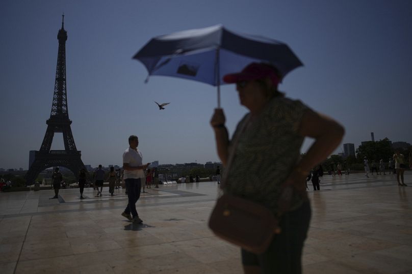
Hot weather has already hit Europe, the start of a predicted heatwave.
In Whitstable, UK, ice cream vans do brisk business and people head to the beach to cool off by the water.
The temperatures being forecast by meteorologists are already causing concern to health professionals.
In the UK, The Met Office says temperatures are set to exceed the 32.8 Celsius recorded in May 1944 over the next few days.
The British Heart Foundation is warning hot weather can present specific risks for people with heart conditions.
And ahead of the British Bank Holiday, Cancer Research UK says its latest figures show a projected record high of 20,800 cases of melanoma skin cancer this year in the UK alone.
It says rates of skin cancer in the UK have increased by almost a third over the past decade.
The UK, which so far this spring has been wet and cool, will see a rise of 15 degrees Celsius over the weekend.
The weather phenomenon is being described by some scientists as a 'heat dome' with pressure trapping hot air over countries like a lid.
Climate researcher Dr Mireia Ginesta from the University of Oxford explains why temperatures are rising.
"What we are experiencing is basically a change in the wind direction so we had winds blowing from the north from higher latitudes, so colder winds during the last week, but from now on we'll have winds blowing from the south."
She says these southern winds are circulating clockwise bringing heat from northern Africa and southern Europe.
Professor Hannah Cloke from the University of Reading goes on to explain that the dome analogy comes from high pressure continuing to hold heat over the continent.
"And there's this area of high pressure sitting over Western Europe, including the UK. and that means that everything sinks down. So the air is sinking and heating up as it sinks, and killing off the clouds as it sinks as well. And that all traps heat near the surface. A bit like putting a blanket over everything," she explains.
"And that allows that warming to build over several days. The sunshine and the drier soils contributing to that, and also the high pressure will then start to bring the air up from the south, where we've got that warmer air coming from northern Africa. Some people are describing this as a heat dome. I might not do that exactly yet, it hasn't become quite as persistent or stationary as for example, we've seen before. and it's not a technical, meteorological term. You know, it's quite useful to think about that type of stationary air making everything hot and like a saucepan lid on top of it. but we're not quite there yet. We have to see how long this persists," says Cloke.
Cloke points out that there are rumbling thunderstorms near Spain which could mean that the anticipated heat doesn't continue to hang around.
While it's usually southern European countries that suffer extreme temperatures, Ginesta says the heat will particularly affect the west and central part of the continent.
She says: "It's especially it's going to hit in the UK, France and Benelux countries more than southern Europe or Spain and Portugal, actually, because the high pressure system will be particularly centred over Central Europe so it's basically these regions that will experience extremely warmer temperatures than usual."
Trapped heat
Solar radiation emitted by the sun falls into two categories, shortwave radiation which comes directly from the sun, and longwave radiation which is heat from the Earth's surface.
Professor Ronita Bardhan from the University of Cambridge says the heavily built up environment in most western cities traps shortwave radiation from the sun, amplifying the heat which has nowhere to go.
She explains: "When the solar radiation hits our environment, generally imagine there were no buildings, no infrastructure being built, it was all natural, part of it will be absorbed within the system, within the Earth system, and the part will be released out. What happens when this long wavelengths and the short wavelengths hit, what happens is a part of that is released out, but the short wavelengths then keep getting reflected within our system. Because now we have built environment, we have built cities in a way where these short wavelengths get trapped within these environment, built environment, and they get reflected constantly within the city space."
Scientists aren't prepared to speculate how long this out of season May heat will continue, but they say Pacific Ocean warming means that as we head towards autumn and later in the year, Europe will begin to feel the effects of a super El Nino weather system.
Ginesta says: "We will have a Super El Nino building over the upcoming year and this will probably bring like more heat domes in the upcoming year, of course. But in this case, in this particular case, we are not expecting that it's influencing (existing high temperatures) basically."
As Europe plans for a sunny weekend, sunseekers are reminded to stay safe in the heat.
Cancer Research UK stresses that around 17,000 cases of melanoma each year are preventable. Almost 90% of cases in the UK are caused by exposure to too much ultraviolet (UV) radiation from the sun and sunbeds.


01:05
More than 1,300 excess deaths recorded in Europe heatwave: WHO
01:11
Increasingly deadly heatwave gives Europe no respite
01:05
Court orders TotalEnergies to account for environmental impact of oil and gas products
01:57
UN warns of worsening Ebola outbreak and El Niño-driven hunger threat
01:17
Much of Europe on red alert as heatwave set to intensify
00:57
UN warns world to prepare for El Nino extreme weather